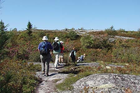
It’s easy with the great network of trails in and around Halifax area
Less than ten minutes of walking on Cole Harbour’s Salt Marsh Trail rewards with a panoramic view of the salt marsh. The trail—built on the abandoned Musquodoboit railroad and now part of the Trans Canada Trail—is a causeway for more than four kilometres, with salt marshes on both sides, offering up equal measures of scenic vistas and salty smells to tingle the senses.
A one-way trip of 6.5 kilometres, the Salt Marsh Trail is a popular spot for locals—walking, biking or, in the winter months, cross-country skiing and snow-shoeing. Fairly level with interpretive signs and benches along the way to sit and take in the scenery, this is a great trail for walkers of all ages and abilities.
Part of the Cole Harbour-Lawrencetown Coastal Heritage Park, the Salt Marsh Trail connects to several other trails for those who want to challenge themselves to a big walking adventure and keep exploring this gem of an area, less than a half hour’s drive from downtown Halifax.
From the beautiful Hemlock Ravine trail, a wooded oasis just off the Bedford Highway in the Rockingham area, to the Bluff Wilderness Trail near Timberlea, offering a mix of barrens, diverse woods and lakes—and more panoramic views—to Duncan’s Cove, a stunning coastline trail and a favourite destination for many local hikers, with regular sightings of seals, and occasionally even whales and porpoises, Halifax area is blessed with a great, and growing, network of trails for day trippers to explore.
For those looking for great walks within metro, here are some more of the area’s best urban trails:
- Shubie Canal.
A bit more than a 10-minute drive from downtown Dartmouth, and on a bus route (#55), Shubie Park and the Shubie Canal trail is an absolute gem and a favourite walking and biking spot for many. Particularly beautiful in the autumn when the leaves begin their show of colours, the Shubie network amounts to nearly 20 kilometres of trail, with lots of small, connecting loops for those looking for a gentle ramble or a leisurely afternoon stroll. - The Bedford-Sackville Greenway Connector.
Fairly new in the urban trail network, this is a favourite with runners and cyclists, not to mention commuters looking for a nicer way to get to work. Although the route runs parallel to the highway in places it’s still a charming nature trail, mostly because it follows the Sackville River. With salmon ladders and signs along the way, families wanting the kids to blow off some steam will find rich educational opportunities along the way. - Sir Sandford Fleming Park.
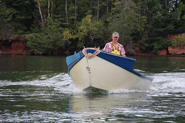
Often referred to as the Dingle Park, this urban oasis is built on land donated by Sir Sandford Fleming—a Scottish-born surveyor and engineer, and the inventor of universal standard time—in 1908. With beautiful views of Halifax’s Northwest Arm, especially from the Dingle tower, this park has woodlands, ponds (the Frog Pond), a beach, a playground and a public boat launch. A great spot for a stroll and a picnic, it’s wheelchair accessible, too. - Point Pleasant Park.
An extremely popular area for dog walkers, runners and people out for a stroll, Point Pleasant Park—located at the very southern tip of the Halifax peninsula—offers nearly 40 kilometres of lovely winding trails through the woods and a wide path that parallels the shoreline. Along with beautiful views of the entrance to Halifax harbour and the wide ocean beyond, expect to find several ruins of early fortifications and artillery batteries—always fun to explore. Wheelchair-accessible in many places. - Waterfront trails.
Although these walks can be very busy, depending on the season, taking a walk or stroll along the waterfront is a great way to pass an afternoon. The Bedford boardwalk in DeWolf Park is just a kilometre long but is well worth the visit with its views of the Bedford Basin and the two bridges. To experience the Halifax and Dartmouth boardwalks, intrepid explorers might consider walking from the south end of the Halifax side first, then taking the ferry across from Halifax and walking along the Dartmouth boardwalk to connect with the Dartmouth Harbourfront Trail that goes about three kilometres to the Woodside Ferry Terminal to catch a ferry back over to Halifax. At about seven kilometres round trip, the views are well worth the effort.
For a full list of trails in and around Halifax, visit: www.halifax.ca/trails or www.halifaxtrails.ca.
Plan your outing
Halifax has a great website with lots of information on the various trails in and around the city, including designated uses, whether or not there are benches and washroom facilities, type of surface and accessibility. Information: www.halifax.ca/trails.
Bedford/Sackville Hiking Trails
- Fort Sackville Walkway Bedford Sackville Connector Greenway
- Length of Trail: 6 kms
- Time to Complete: 2.5 hours return
- Trailhead: (1) Fultz House, 33 Sackville Dr. (2) Scott Manor House, 15 Fort Sackville Rd.
- First Lake Glen Slauenwhite Trail
- Length of Trail: 3.3 kms
- Time to Complete: 2 hours
- Trailhead: (1) First Lake Dr. (2) Glendale Dr.
Cole Harbour/Eastern Shore Hiking Trails
- Atlantic View Trail
- Length of Trail: 10 kms
- Time to Complete: 3-4 hours return
- Trailhead: Lawrencetown Beach.
- Cole Harbour Heritage Park
- Length of Trail: 9 kms
- Time to Complete: Varies depending on route
- Trailhead: 256 Bissett Rd. (also Salt Marsh Trail).
- Musquodoboit Trailway
- Length of Trail: 15 kms
- Time to Complete: 6-8 hours return
- Trailhead: (1) Highway 7 at the Musquodoboit Railway Museum. (2) At Park Road. (3) Highway 357 at Gibraltar Rock.
- Salt Marsh Trail
- Length of Trail: 6.5 kms
- Time to Complete: 4-6 hours return
- Trailhead: 256 Bissett Rd. (also Cole Harbour Heritage Trail).
- North/South Granite Ridge Trails Gibraltar Rock, Admiral Lake Bayers Lake loop trails
- Length of Trail: 25.7 kms
- Time to Complete: 2-8 hours, depending on routes/loops completed
- Trailhead: Park Road, Musquodoboit Harbour and Gibraltar Rock, Meaghers Grant.
- Crowbar Lake
- Length of Trail: 18 kms
- Time to Complete: 2-10 hours, depending on route
- Trailhead: 1800 Myra Rd., Porters Lake.
Dartmouth Hiking Trails
- Portland Lakes Greenway
- Length of Trail: 2.2 kms
- Time to Complete: 45 minutes
- Trailhead: (1) Baker Dr. at Norman Newman Dr. (2) Between HRM soccer fields off Portland Hills Dr. Parking and access also at Birches Park, Portland Estates Blvd.
- Shubie Canal Greenway Corridor
- Length of Trail: 18.5 kms
- Time to Complete: 6 hours return, depending on route
- Trailhead: Fairbanks Centre Shubie Park, 54 Locks Rd., off Waverley Rd.
Halifax Hiking Trails
- Chain of Lakes Trail
- Length of Trail: 7.25 kms
- Time to Complete: 2 hours
- Trailhead: Joseph Howe Dr. across from Atlantic Superstore.
- Frog Pond Trail
- Length of Trail: 1.4 kms
- Time to Complete: About 30 minutes.
- Trailhead: 2.2 km after the intersections of Herring Cove Rd. and Purcell's Cove Rd.
- Sandford Fleming Park
- Length of Trail: 2.8 kms
- Time to Complete: About 35 minutes.
- Trailhead: Access from the Dingle Tower parking lot or lower boat launch parking lot. The loop section has access off of the Dingle Road.
Timberlea/St. Margarets Bay Hiking Trails
- Beechville Lakeside Timberlea Trail
- Length of Trail: 13 kms
- Time to Complete: 5 hours
- Trailhead: Lakeside Dr. in Lakeside Industrial Park (next to the Coca Cola plant).
- St. Margaret’s Bay Rails to Trails
- Length of Trail: 32 kms
- Time to Complete: 2 days
- Trailhead: (1) Station Rd., Hubbards. (2) Head of St. Margaret’s Bay on Station Rd. (3) Highway 3 at Hubley.
- The Bluff Wilderness Trail
- Length of Trail: 32 kms
- Time to Complete: 3-6 hours per loop.
- Trailhead: Parking lot at 2890 St. Margaret’s Bay Road. Follow the Beechville Lakeside Timberlea (BLT) Trail sign at the back of the lot west for 0.7 km to the Bluff Wilderness Trail trailhead.